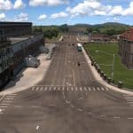
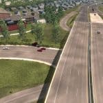
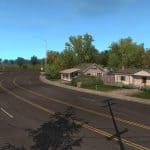
Project East v0.4.7.1 – Idaho & Wyoming 1.37 Map
Changes v0.4.7.1:
– Fixed some issues with Links package w/ Montana Expansion
Changes v0.4.7:
– Some bug fixes
– Preparation for Version 0.5
– Wyoming Signage Improvements
– A new optional file : Project East & Montana Expansion Links.scs*
– Other small map additions
Changes v0.4.6
– Bug fixes in WY and ID
– Town of Evanston, WY refreshed
– I 80 Improvements (Rock Springs & Evanston)
– Manila, UT weigh station
– Other small map additions
Changes v0.4.5
– Over 100 bugs resolved. (See discord #Bugreports)
– Added Manila, UT
– Added US 191 from Rock Springs to Vernal Utah.
– Added UT 44 from US 191 to Manila UT
– Added WYO 530 from Manila UT to Rock Springs (Green River)
Changelog v0.4.4:
– Renamed Project North to Project East
– Updated graphics, to accommodate the new name
– Put all of the custom assets inside of one .scs file. Now you have Project North 0.4.4.scs and Project North Assets.scs.
– Updated load order.
Changelog v0.4.3:
– US 191 Changes & Fixes:
Fixed terrain gaps
Fixed rock in the road causing damage
Fixed flying waterfall
Fixed render distances
– Jackson Fixes:
Fixed sign in the middle of the road
Fixed disappearing AI traffic on main road
– Boise & Area:
Removed dynamic road signage, speed limit is 65 mph on I 84 now.
Fixed holes in scenery
Changelog 0.4.2
– Made the non C2C version of Montana Expansion Compatible
– Linked the non C2C version of Montana Expansion up With Project North via I 15
– Fixed various bugs, like terrain gaps and invisible walls.
– Fixed GPS routing errors. GPS works across I 80.
– Added small town of Superior, WY east of Rock Springs
– Fixed rendering distances in hundreds of locations
– Should be very stable.
Changelog 0.4.1
It fixed invisible barriers and some other minor issues. It also fixes holes in Boise, ID and invisible walls in Pocatello.
Changelog v 0.4.0
Added
Cities
Rock springs
Evanston
Pinedale
Roads
Highway 80 and the road from Highway to I84 at Rock Springs
Highway 191 from Highway 80 from Rock Springs to Jakson
Highway 15 from Pocatello to Odgen exit
Utah DLC Now Required
Map connected by road to Utah
Changelog v 0.3.1
that fixes major issues in Washington along with some other minor issues.
Changelog v0.3.1
Fixed Invisible Barriers in Pocatello Area
moved reflectors sticking up out of the ground along I 84 (Mtn Home – Twin Falls)
Fixed render distances across the state
Fixed holes on US 93 (You should now be able to see mountains etc)
Fixed terrain gaps in hundreds of places.
Changelog 0.3
Idaho Contents:
– City: Twin Falls
– City: Pocatello
– City: Idaho Falls
– Back roads in between Twin Falls and Pocatello
– Iconic landmarks, such as Snake River, Island Park, West Yellowstone & more
– Unique Interchanges, such as a DDI and stack interchanges.
– I 84 Extention (Mtn Home – I 86)
– Road: I 86 (I 84 – I 15 [Pocatello])
– Road: I 15 (Pocatello – Idaho Falls)
– Road: US 20 (ID Falls – W. Yellowstone)
– Road: ID 33 (US 20 – WYO 22)
Montana Contents:
– Town: West Yellowstone
– Road: US 20
– Scenic Mountain Passages
Wyoming Contents:
– Town: Jackson
– Road: WYO 22 (Jackson – ID 33)
– Town: West Yellowstone
– Yellowstone Nat Park View Points
– Scenic Mountain Passages
Test 1.36
Read me:
1.) Like previous versions, you will need the latest free version of Mega Resources
2.) Inside Project East 0.4.7, you will have three .scs files, the first is Project East x.x.x and the second is Project East assets. Ensure both of those are enabled. The third is Project East & Montana Expansion Links, only use that with Montana Expansion. If you aren’t using Montana Expansion, you do not need to activate it.
3.) Changes have occurred in the installation process. It is recommended you look at the load order again

